Local News
Severe Weather Potential Increasing for Lebanon Area Tonight and Wednesday
By Lebanon Now Staff ·
Lebanon and the surrounding area could see two rounds of severe weather over the next two days, with the first chance arriving late tonight and another potentially stronger round Wednesday evening and overnight.
Mike Stanieck the Laclede County Office of Emergency Management shared an update Tuesday evening following a new briefing from the National Weather Service in Springfield.
Severe Weather Possible After Midnight Tonight
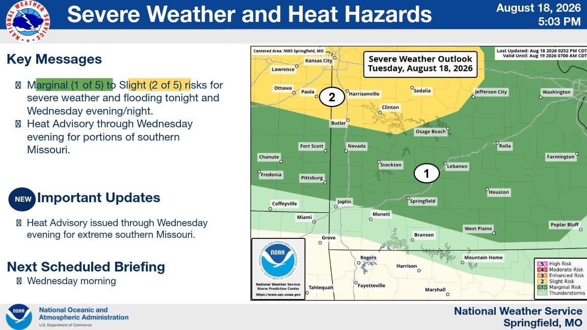
The National Weather Service currently has the Lebanon area under a Marginal Risk, Level 1 of 5, for severe weather tonight.
A complex of thunderstorms is expected to develop and move toward the area late tonight into Wednesday morning. The exact track remains uncertain.
The main threats tonight include damaging winds, heavy rainfall and hail potentially up to quarter size. There is also a very low tornado threat.
Damaging winds are expected to be the primary concern.
Wednesday Could Bring a Greater Severe Weather Threat
The bigger concern may come Wednesday.
The National Weather Service has placed the Lebanon area in a Slight Risk, Level 2 of 5, for severe weather Wednesday.
Damaging winds remain the primary hazard, but hail and a tornado are also possible.
The exact threat level will depend heavily on what happens with tonight's storms and how the atmosphere recovers afterward.
Sanosek said that makes it important for residents to continue watching the forecast even after tonight's storms have passed.
Heavy Rain and Flooding Also Possible
Heavy rainfall is another concern over the next two days.
The National Weather Service says rounds of heavy rain could produce flooding, particularly across portions of central Missouri tonight and the eastern Ozarks on Wednesday.
For Lebanon specifically, rain chances increase significantly late Wednesday night, reaching 65 percent around midnight Wednesday night into Thursday morning.
Heat Remains a Concern Wednesday
Severe weather isn't the only weather concern.
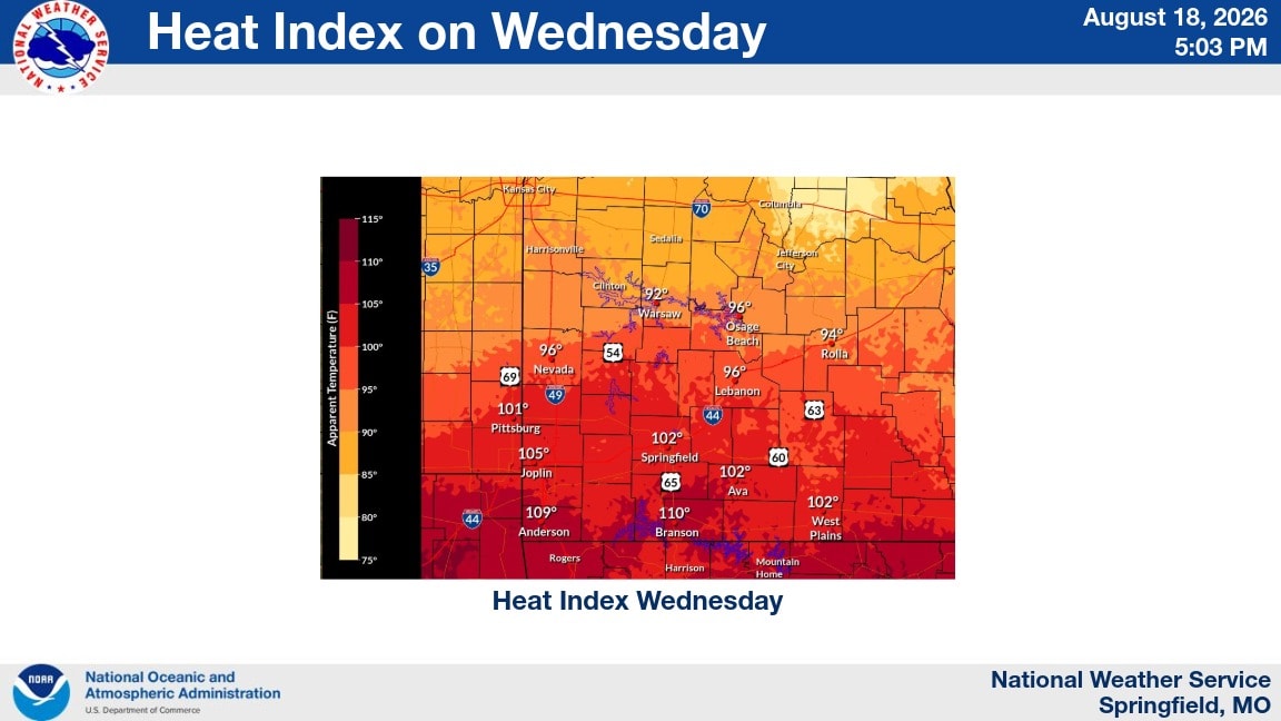
Wednesday's forecast calls for a heat index around 98 degrees in Lebanon, while areas farther south could see heat index values between 105 and 110 degrees.
A Heat Advisory is in effect through Wednesday evening for portions of southern Missouri.
Stay Weather Aware Over the Next Two Days
Sanosek is asking everyone to stay weather aware over the next two days.
Keep an eye on trusted weather sources, make sure your weather radio is ready, keep emergency alerts such as Nixle turned on and have a way to receive warnings overnight while you are sleeping.
The National Weather Service says the situation remains dependent on how tonight's storms develop, and additional changes to Wednesday's severe weather threat are possible.
The next scheduled National Weather Service briefing is Wednesday morning.
Stay tuned to Lebanon Now as we continue to follow the weather and share updates for Lebanon and Laclede County.